How Businesses Are Turning Space Data into a Tool for Risk, Resilience, and Sustainability
The global space economy has boomed over the past decade, with the market expected to grow from $630bn in 2023 to $1.8 trillion in 2035.
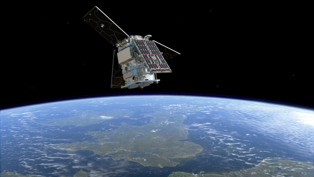
From SpaceX launching its Falcon rocket with Starlink satellites for the 500th time, to BlueOrigin opening the doors to commercial space travel, the cosmos is no longer solely a tool for exploration, but today, a resource for businesses. Now, satellites provide companies with essential data to make more informed decisions, streamline processes, reduce risk, and track environmental change in real time.
For example, recent reporting from Al Gore’s Climate TRACE shows how real-time satellite data from 300-plus satellites can help pinpoint pollution sources worldwide, helping businesses and policymakers save millions of lives each year.
The need for space technology has never been greater. As climate change accelerates, supply chains become increasingly complex, and sustainability regulations tighten, businesses need accurate, actionable data more than ever.
With that in mind, here is how companies from industries such as insurance, supply chain and sustainability are already tapping into the power of space data.
Insurance: From climate risk to nature risk
Insurers have historically used satellite imaging to assess risks like flooding, wildfire, and storm damage. Underwriters use information from satellites to set premiums, and process claims more efficiently. \n \n Yet, as climate change’s impact grows, insurers now face a new challenge: biodiversity and land-use risk.
The risks of habitat loss, deforestation, and potential floods or wildfires can lead to the mispricing of risk which in 2024 alone, cost private carriers $154 billion in unexpected claims. The challenge is that relevant data about how these risks affect their clients have been difficult to find.
However, there are companies helping to change this with space data, one example being CATALYST. The satellite technology company is working with corporate insurer Howden on one of six projects funded under the UK Space Agency’s Unlocking Space for Business program. It is developing a satellite-based tracking platform that tracks change in land-use to quantify and assess biodiversity risk across insurance portfolios.
Rather than simply marketing “real-time data,” modern insurers are beginning to stitch satellite feeds, like optical, thermal and synthetic aperture radar (SAR), with ground sensors and topographic models to generate probabilistic risk maps that bring more transparency to underwriting and claims.
NOAA uses its Geostationary Operational Environmental Satellites (GOES) and the Joint Polar Satellite System (JPSS), plus radar, to track floods even when clouds block the view. Insurers are borrowing the same approach: mixing satellite feeds to spot deforestation or confirm claims in real time. According to Reinsurance News, ICEYE is among the firms testing it, and the results feed directly into new disclosure rules like the Taskforce on Nature-related Financial Disclosures.
Sustainability: Satellites and the business of nature
As sustainability moves from voluntary to mandatory reporting, corporations now must measure all of their environmental effects: not only in carbon but nature.
Furthermore, the TNFD have announced this week that over 600 global brands, collectively representing $6.5 trillion in market capitalization, are embracing its nature reporting guidelines.
Satellites lie at the core of the shift. They not only monitor emissions and methane leaks but also how deforestation, agriculture, and wetland destruction are able to bring about large shifts in ecosystems.
The range of providers is broad. Satelligence helps agribusiness giants like Cargill identify threats of deforestation and deploy solutions across its agricultural supply chains. Meanwhile, satellite data analytics company Planet Labs is working with the German government to supply high-resolution imagery for ecosystem monitoring and reforestation tracking. EarthDaily and Maxar, meanwhile, run mapping platforms that let both companies and governments measure how land use is shifting and whether conservation efforts are actually working.
Supply chains: Smarter, faster, and more Resilient
Supply chains are increasingly being pinched by global shocks, climate extremes, and most recently, geopolitical frictions caused by US tariffs. Disruptions cost a lot: large companies can lose up to 45% of annual profits for a decade from supply chain disruptions, according to McKinsey research.
Again here, space data is becoming a factor of competitiveness. Satellite constellations allow businesses to track assets, monitor infrastructure, and anticipate risks that were previously invisible.
For example, Orbital Insight, which was acquired by Steve Wozniack’s space firm Privateer last year, employs satellite imagery and geospatial analytics to track global oil supplies, retail sales, and farm production so that companies can predict shortages and price movements. Manufacturers and retailers can both use the platform to view how congestion in their ports is impacting them and to monitor warehouse activity.
Meanwhile, Spire Global just secured a $2.5 million contract with the NOAA to supply satellite-based weather data allowing shipping companies to forecast delays, chart best routes, and improve against disruptions to the global supply.
Ten years ago, satellites were the domain of astronauts and national agencies. Today, they’re APIs, data streams, and dashboards that tell us if cargo is late, forests are shrinking, or claims risk is spiking. Space data isn’t a distant resource anymore; it’s infrastructure. And as costs drop and constellations grow, expect it to shape how every boardroom thinks about resilience.
\
:::info Lily Blake - Journalist - 150Sec
:::
\

추천 콘텐츠

Russia’s Sberbank Ready to Enter Crypto Trading as Russia Moves Toward Regulation

Trump sets April 30 deadline for Iran to propose negotiation plan