Tropical Storm Caloy in PAR, but not seen to affect Philippine weather
MANILA, Philippines – The tropical storm with the international name Hagupit entered the Philippine Area of Responsibility (PAR) at 6 pm on Saturday, May 9, but it is not expected to have an impact on weather in the country.
It was given the local name Caloy, as the Philippines’ third tropical cyclone for 2026.
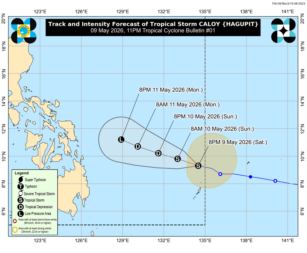
The Philippine Atmospheric, Geophysical, and Astronomical Services Administration (PAGASA) said Caloy was located 870 kilometers east of northeastern Mindanao as of 10 pm on Saturday, moving west northwest at 20 kilometers per hour (km/h).
The tropical storm has maximum sustained winds of 65 km/h and gustiness of up to 80 km/h.
It is not bringing rain to any part of the Philippines, and there are no tropical cyclone wind signals in effect. The whole country has generally fair weather, with just isolated rain showers or thunderstorms due to the easterlies or warm winds from the Pacific Ocean.
PAGASA said Caloy will remain over the Philippine Sea, far from landmass. It is also likely to weaken into a tropical depression by Sunday evening, May 10, and into a remnant low on Monday, May 11.
In the next 24 hours, however, the following seaboards may have up to moderate seas:
- Eastern seaboards of Northern Samar, Eastern Samar, and Siargao-Bucas Grande Islands; seaboards of Batanes; western seaboard of Babuyan Islands; northwestern seaboard of Ilocos Norte – waves up to 2.5 meters high
- Remaining seaboards of Ilocos Norte and Babuyan Islands; eastern seaboards of Cagayan, Isabela, Camarines Norte, Catanduanes, Albay, Sorsogon, Dinagat Islands, Surigao del Sur, and Davao Oriental; northern seaboards of Camarines Sur, Catanduanes, and Northern Samar – waves up to 2 meters high
The weather bureau advised small vessels to take precautionary measures, or to avoid sailing altogether.
Aside from Caloy, PAGASA is monitoring a new low pressure area (LPA) outside PAR, which was last spotted 2,915 kilometers east of northeastern Mindanao at 8 pm on Saturday.
The LPA is unlikely to develop into a tropical cyclone in the next 24 hours. More details are expected in the coming days. – Rappler.com


You May Also Like

Gold continues to hit new highs. How to invest in gold in the crypto market?

SHIB Price Prediction: Critical $0.0000085 Target Emerges as Bears Challenge Bulls